|
|
|
A49
|
Priener Hütte » Spitzsteinhaus
|
|
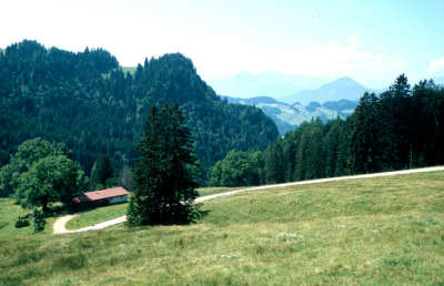
The stage from the Priener Hut via Sachrang to the Spitzsteinhaus lodge is leisurely and not overly long. This gives the opportunity to have a look around in the Peter-Müller-Museum in Sachrang. From Sachrang, go upwards across the Obermoosalm and the Mesneralm pastures, sometimes over meadows and sometimes through woodland to the Spitzsteinhaus lodge, which already lies in Austrian territory.
Detailed route description

From the Priener Hut, follow the forest road westwards across the Niederkaseralm meadow to the Talalm meadow. Shortly before the Talalm, the path opens out onto another, where you must keep to the left and thus arrive at a second signpost at which the trail goes to the right. It passes across the alpine meadowland and later goes downhill through the wood. You will come onto the forest path again and keep to the right. Follow the road through the wood, always on a slight decline. After the sharp bend, walk past the little Judensee lake before soon arriving back on open terrain. Skirting the edge of the wood, Via Alpina leads further downhill and the last stretch to Sachrang once more runs through the wood. In the little village of Sachrang, you can take a look around the Müller-Peter-Museum, which tells the story of Peter Huber, an outstanding personality and a type of all-round 18th century genius whose fame reached far further than the borders of Sachrang. In Sachrang, turn immediately right after the parish church onto the roadway leading to Mitterleiten. After the first bend, the hiking trail turns to the right towards the Spitzsteinhaus refuge. Head across fields and sometimes for a short while woodland to reach the Obermoosalm meadow. Then head uphill through the wood to the Mesneralm meadow at 1,197m in altitude. Via Alpina then leads further westwards at a comfortable pace through the wood. Cross the Spitzmoosalm meadow and you will come to a roadway that leads on the left to the German-Austrian border and directly to the Spitzsteinhaus lodge.
(Michael Kleider, Christina Schwann, OeAV)
Natural and cultural heritage
The little village of Sachrang is better known thanks to Peter Huber as the “Müllner-Peter von Sachrang”. He was born in Sachrang in 1766 as one of eight children and worked mainly as a miller and farmer. In 1809 he took over the property and corn mill of his parents. Due to his talents in a wide range of areas, however, he became known even beyond Sachrang as a type of all-round genius. He had outstanding musical talent, and as a composer and choir leader he made his mark on the music of his local community (mainly preserved in the “Sachranger Notenschatz” music archives). His second passion was medicine, and his advice in matters of health was highly rated. He also enjoyed a good reputation as a thinker and citizen. In 1817, he was made chairman of the parish council in Sachrang. Peter Huber was dedicated to achieving enlightenment and served the interests of his fellow citizens at a time when most people were struggling just to survive. The turmoil of the Napoleonic wars advanced as far as Sachrang at the time, endangering the harvest and sowing poverty and troubles. With new ideas that stood against oppression, poverty and violence, he defended the cause of a “social coexistence” of people and initially came up against intense opposition in the community. Peter Huber died in 1843. He is buried in the graveyard of St. Michael parish church in Sachrang, which is worth a visit. On the Priental hiking trail from Aschau in the Chiemgau mountains to Sachrang (approx. 12km), you can follow in the footsteps of Peter the Miller: “auf die Spuren des Müllner-Peter”. The parish church of St. Michael in Sachrang is one of the most beautiful churches in the Chiemgau mountains. The tower of the baroque construction is decorated by a Tyrolean lantern cover. The church interior is decorated in the baroque style of the Graubündner school, and numerous hand-wrought gravestone crosses stand in the graveyard.
(Michael Kleider)
Other long-distance trails and alternative routes
Ascent of the Spitzstein (1,596m) walking time of 45min
Useful topographic maps
-
WK 301 Kufstein - Kaisergebirge - Kitzbühel ~ Freytag & Bernd (1:50.000)
-
Nr 10 Chiemsee - Simsee ~ Kompass (1:50.000)
-
ÖK 50 90 ~ Bundesamt für Eich- und Vermessungswesen (1:50.000)
Websites relative to natural and cultural heritage
Last update : 2011-08-17

 |
3h30 |
12.2 km
|
587 m
|
750 m
|
3h30 |
12.2 km
|
587 m
|
750 m


Favourites, criticisms ? Make your personal comments on this stage. For more general notes please use the comments section of the page Over to the Via Alpinists.