|
Create your own guidebook
Location
Key to symbols

|
 |
4h00 |
10.67 km
|
1021 m
|
573 m |
4h00 |
10.67 km
|
1021 m
|
573 m
This is a long stage, climbing Orco Valley to Ceresole Reale and its large artificial lake. It skirts around the southern end of the Gran Paradiso national park via a long series of roads, trails and dirt tracks, more or less at constant altitude, along the slopes of the valley. Half way along is the village of Noasca.
Detailed route description

Other long-distance trails and alternative routes
The trail partly follows the route of GTA stages 227 & 228.
Useful topographic maps
Useful guidebooks
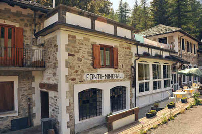
Picture gallery


Add your own pictures!
Last update : 2013-05-29
|
|||||||||||||||||||||||||||||||||||||||||||||||||||||||||||||||||||||||||||||||||||||||||||||||||||||||||||||||||||||||||||||||||||||||||||||||||||||||||||||||||||||||||||||||||


Favourites, criticisms ? Make your personal comments on this stage. For more general notes please use the comments section of the page Over to the Via Alpinists.